How to Design Private 5G/LTE Networks for Mines Using Atoll
Introduction
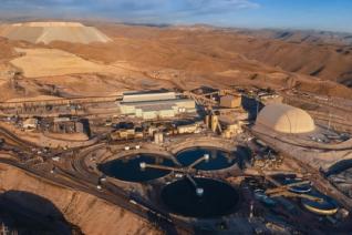
Designing a private 5G/LTE network for a mine is a complex RF planning task. Mines combine large outdoor areas, evolving terrain, remote backhaul constraints, underground tunnels, chambers, and safety-critical operational requirements. A useful planning workflow must account for all these elements together.
The webinar demonstrated how Atoll can support this workflow, from terrain data integration to coverage analysis. This article summarises the technical planning steps shown in the session.

Step 1: Build the mine environment with terrain data
The first step is to represent the mine environment accurately. In open-pit mines, terrain is a core part of the RF model because slopes, benches, walls, and elevation changes affect propagation and line-of-sight conditions.
Atoll can use terrain information and contour data to build a 3D representation of the mine. This allows planners to model the current mine geometry and update it as the mine evolves.
A typical workflow includes:
- Importing terrain, GIS, or contour information.
- Representing the open pit and surrounding terrain.
- Checking elevation profiles and terrain effects.
- Updating the data when the mine changes.
- Re-running predictions to assess the effect on coverage.
This is important because a design that works with outdated terrain may not reflect the operating conditions in the mine.
Step 2: Plan microwave backhaul links
Mining sites are often remote, and base stations may need microwave connectivity to reach the wider network. The webinar showed how Atoll can support microwave link analysis by evaluating possible paths and identifying obstructions.
In this stage, planners can:
- Identify candidate site locations.
- Evaluate potential microwave paths.
- Check line-of-sight availability.
- Analyse terrain obstructions.
- Compare alternative routes.
This helps reduce manual work and supports more reliable backhaul design decisions. For mines, this is especially important because terrain changes and site constraints can make link planning difficult.
Step 3: Model underground tunnels and chambers
Mines often include underground areas that cannot be planned with a simple outdoor model. Tunnels, ramps, chambers, and varying elevations create a different propagation environment.
The webinar demonstrated how Atoll can be used to create and model underground spaces. Planners can draw tunnel layouts, account for different elevations, and include chambers as part of the design.
A practical workflow includes:
- Creating the underground layout.
- Defining tunnel geometry and elevation.
- Adding chambers or operational areas.
- Placing network equipment in relevant locations.
- Running coverage predictions for underground areas.
This makes it possible to plan surface and underground connectivity within a consistent project workflow.
Step 4: Use real equipment in the design
A network plan needs to reflect deployable equipment. The webinar showed equipment design capabilities involving antennas, radiating cables, amplifiers, splitters, and related components.
Using equipment-specific parameters helps ensure that the design is closer to real deployment conditions. It also supports better communication between planners, implementation teams, and installers.
Useful outputs can include:
- Schematic views of the network design.
- Equipment placement information.
- Connection views.
- Deployment-oriented documentation.
This is particularly useful in underground environments, where radiating cables and associated components may be part of the coverage solution.
Step 5: Run coverage and quality analysis
Once the environment, sites, links, and equipment are modelled, planners can run coverage predictions. The webinar focused on using Atoll to analyse network performance across mine environments.
Coverage analysis can help planners:
- Identify weak coverage areas.
- Compare candidate site locations.
- Adjust antenna placement and parameters.
- Evaluate both surface and underground coverage.
- Support design decisions with visual outputs and reports.
The value of this step is that it turns the network design into evidence that stakeholders can review and act on.
Step 6: Iterate as the mine evolves
Mining environments change. A private network plan should therefore be treated as a living design, not a one-time drawing. As terrain, tunnels, and operational zones evolve, planners can update the model and re-run predictions.
This iterative workflow is one of the key advantages of using a dedicated radio planning platform for mines. It allows engineering teams to keep the network aligned with the operational reality of the site.
Conclusion
Atoll supports a complete planning workflow for private 5G/LTE networks in mines. The webinar demonstrated how planners can combine terrain modelling, microwave backhaul analysis, underground tunnel design, equipment modelling, and coverage prediction in a single environment.
For RF engineers and private network teams, this provides a practical way to design mining networks with more confidence and fewer assumptions.